
Temperature: 72-82
Weather: Mostly Sunny
Wind: Slight East
Water Surface: Flat to 12”
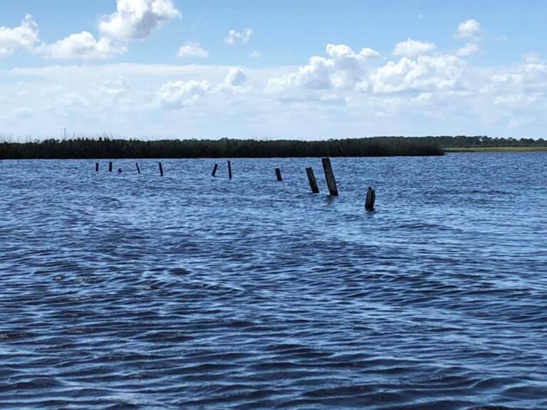
Finally, after exploring these remote waters for the past year and a half today with good (high) water we were able to transit this entire isolated section of the St. Johns River. We put in at the hatbill sand ramp. Paddled through Lake Ruth, Clark, Loughman and finally into Salt Lake. Between the lakes like a spider’s web are miles of twisting, turning, tributaries. A confusing maze of dead ends, sandbars and due to rainfall or lack of low to no water. With these conditions it is no wonder this area like most of the 110 miles of the upper St. Johns can be so totally isolated. From SR 520 to SR 46 these 35 miles with its 5-mile-wide flood plain, including the area we paddled today, is surrounded by over 85,000 acres of pristine wilderness including: (East Side) Tosohatchee Wildlife Management Area, Bronson State Forest, Little Big Econ State Forest, Lake Jesup Conservation Area. (West Side) St. Johns National Wildlife Refuge, Salt Lake Wildlife Management Area, and Buck Lake Conservation Area.
Although just to be here on the St. James is reward enough all of my trips involve information gathering: reading, talking with the old Crackers, Historical Societies, old County Maps and Records, before going out and trying to locate these landmarks from the past. Seminole war forts, trading posts, old military roads, river crossings, the indigenous Indian middens and villages, old homesteads and towns, historical battles and finally today after a few attempts what may very well be the remains of the loading dock on Salt Lake.
It is important to understand the character of the river. From the mouth at Jacksonville the lower and middle section of the St. Johns River (200 miles) the water depth averages 11 ft. The upper St. Johns South, from Lake Harney to the headwaters at Fort Drum (110 miles) averages from 4 to 6 feet in depth with numerous sandbars and low water. Aside from the connective lakes the river sections here average from just getting your kayak thru to 40’. From Jacksonville to Enterprise on lake Monroe the large steamboats would have to unload their cargo onto smaller paddleboats for the journey south. From there they would get as far south and east to an area known as the Hatbill. Unless the water level was especially high they would have to unload yet again onto rafts which would then be poled east 5 miles to Salt Lake. There a 7-mile tram was constructed to Sandpoint in Titusville. The importance of the St. Johns cannot be understated. From the late 1820’s Until Henry Flagler brough his railroad through Central Florida in 1894 this was the sole means of moving people and product back and forth in Florida. These few docks sites at Salt Lake and at Rockledge creek off Lake Florence were crucial to the survival of these early settlers.
To ply these same waters as the hearty pioneers long before, our journey today, those to come.
With my good friend Jim Durocher.
Mark Nathan