Today I’m 50 miles further North from my last excursion into the
Jane Green Swamp on 10-8-25. As a crow flies it’s less than 20 miles between hwy 50 and 46 with the floodplain up to 7 miles across. Yet there are hundred of miles of unseen and untraveled tributaries, sloughs and river channels waiting to be explored, crisscrossing this labyrinth of ancient waters, most only accessible by paddle boats. The disquieting pleasure of keeping one’s bearing only adds to the allure of paddling these challenging waters. The peace and mystique only adds to journey.
Because of the extreme high water levels I think it might be possible to locate and access a small obscure tributary that would
enable me to access the far South and East River quadrant
of the North River channel.
As always it takes a lot of planning, map reading,
looking at satellite images, luck and the conditions
must be optional.
I’ve been here a dozen times before on these remote wilderness river corridors and have not seen, even a hint where this hidden waterway I’m looking for might be.
If I can find its whereabouts and access this channel
I could paddle an area I’ve yet to explore and be in
15 minutes where it would take hours coming around.
I make it to the area where the channel should be
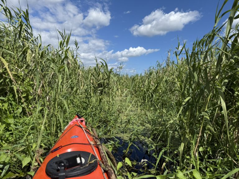
but all I see is a wall of Coastal Willows, Maiden Cane and Flags.
It takes some time but I finally locate the small water passageway
I’m looking for. Surprisingly the Maiden cane laying over the tributary are easily pushed aside. I have a good 15-point hand saw that I always carry but hand pruners are what I really need to make any real head way. Everywhere around is a floodplain, there is nowhere to get out from start to finish. The tributary we’re on is surprisingly deep at 6’.
I was also hoping while on this tributary I might be able to locate a
large hammock of Sabal Palms a “Cathedral of Palms” that I’d noticed on a google earth search that seemed curious. Curious in that there would be upland area of dry ground with Palms surrounded by an endless floodplain. It could be an ancient Indian Midden so would be worth a look. I’m within 30 feet of this upland area and the palms, with a wall of Cane and deep water between us
unless I can fly, I’ll have to find another way another time.
I located a midden about 2 miles from here on the edge
of Salt Lake Conservation Area on a solo trip 2 years ago
thanks to coordinates from Joe Dunn of Florida Trailblazer.
Another adventurer and historian on Florida’s amazing history.
Joe accesses these sights and remote areas of interest by foot,
while I do the same by river.
If this is a midden it would be from the indigenous natives that were here when the first Spaniard’s came in 1513, the Ais or Tuscana. War, disease and bondage by the Spanish and to some degree the British and French decimated these native tribes to when Spain traded England, Florida for Cuba in 1763 the Spanish left with the last hundred of these decimated native peoples in bondage. In just 250 years, the European powers had effectively wiped out the entire Indigenous Indian population in Florida. Up until then these ancient peoples had lived here in La Florida for over 10,000 years. Although I wasn’t able to access the tributary as planned or succeed in my objectives, I will be back.
Paddling these remote river channels as the
ancients before. Turning the next corner hoping to get a glimpse.
It’s easy to imagine they’re here, with me in their dugout canoes
looking around the same corners, on their way, as I am now, albeit so long ago. The gargling of the moorhens hidden in the thick brush as we pass. The wind whispering thru the Giant Maiden Cane and Flags like a lullaby as it lulls us along.
With every hope the Upper St Johns will stay pristine,
remote and retain its solitude as it flows along
on her slow methodical journey to the Ocean… Far
Far from the madding crowd.
With Ernie Green.
Mark Nathan
St Johns River Explorer