Search

Category: Adventures

St Johns River Kayak Trip: March 4, 2026

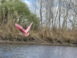
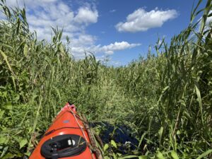
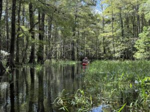
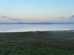
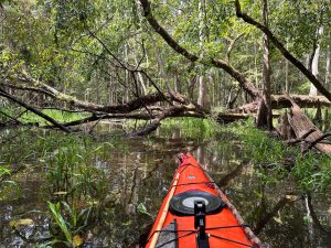
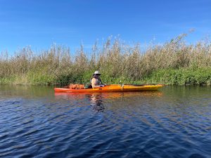
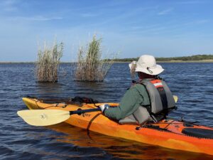
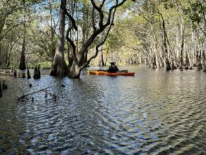
St Johns River Kayak Trip: March 4, 2026 Weather: SunnyMiles: 7.5 Time: 4.5 hours Temp: 68-76Wind: 10-20 mphWater depth: Medium I decided to repeat this trip I made 3 years ago with Ernie Green. I’m here to evaluate the health of the wildlife and the river in this area, specifically the alligators. I’ve been documenting my findings on the upper St Johns now for over 15 years. We did not see the White Pelicans as we did three years ago but that’s always a crap shoot. We didn’t put in until noon so most of the wading birds were feeding in smaller numbers and not gathered in flocks. The gators though were in large numbers due to low water with plenty of banks for sunning. I’ve rarely seen so many specimens (12′ and over) in such a short time, and for that I’m thankful in that there are fewer of these giants every year.I have talked with the FWC and have advocated for a slot limit on gator hunting like we do with other hunted species. Every year the average size of the gators taken are smaller than the years before. These specimen gators can be as much as 80 years old. The attrition rate of these colossal breathtaking creatures can not be made up. As long as the annual Gator hunt is nothing more than a trophy hunt there will always be less of these giants in our midst until there are only stories to tell.We had an unprecedented hard freeze a couple of weeks ago and is why all the lush greenery has been so severely damaged. Should be back to normal by Spring. With Ernie Green and my nephew Troy Nathan.Try and do something every day to save our wild Florida. Be part of of it. Enjoy the PicsMark NathanSt Johns River Explorer

Listen >

St Johns River Kayak Trip: Oct. 17, 2025

St Johns River Paddle 10-17-2025 Where: Upper St. Johns River – North River Channel Between hwy 50 & 46. Temp: To the mid 80’s. Weather: Clouds & Sun Wind: Slight 5 – 15 mph Water Conditions: All Glass with slight chop on main river channel Water Level: Very High – 6.7 Today I’m 50 miles further North from my last excursion into the Jane Green Swamp on 10-8-25. As a crow flies it’s less than 20 miles between hwy 50 and 46 with the floodplain up to 7 miles across. Yet there are hundred of miles of unseen and untraveled tributaries, sloughs and river channels waiting to be explored, crisscrossing this labyrinth of ancient waters, most only accessible by paddle boats. The disquieting pleasure of keeping one’s bearing only adds to the allure of paddling these challenging waters. The peace and mystique only adds to journey. Because of the extreme high water levels I think it might be possible to locate and access a small obscure tributary that would enable me to access the far South and East River quadrant of the North River channel. As always it takes a lot of planning, map reading, looking at satellite images, luck and the conditions must be optional. I’ve been here a dozen times before on these remote wilderness river corridors and have not seen, even a hint where this hidden waterway I’m looking for might be. If I can find its whereabouts and access this channel I could paddle an area I’ve yet to explore and be in 15 minutes where it would take hours coming around. I make it to the area where the channel should be but all I see is a wall of Coastal Willows, Maiden Cane and Flags. It takes some time but I finally locate the small water passageway I’m looking for. Surprisingly the Maiden cane laying over the tributary are easily pushed aside. I have a good 15-point hand saw that I always carry but hand pruners are what I really need to make any real head way. Everywhere around is a floodplain, there is nowhere to get out from start to finish. The tributary we’re on is surprisingly deep at 6’. I was also hoping while on this tributary I might be able to locate a large hammock of Sabal Palms a “Cathedral of Palms” that I’d noticed on a google earth search that seemed curious. Curious in that there would be upland area of dry ground with Palms surrounded by an endless floodplain. It could be an ancient Indian Midden so would be worth a look. I’m within 30 feet of this upland area and the palms, with a wall of Cane and deep water between us unless I can fly, I’ll have to find another way another time. I located a midden about 2 miles from here on the edge of Salt Lake Conservation Area on a solo trip 2 years ago thanks to coordinates from Joe Dunn of Florida Trailblazer. Another adventurer and historian on Florida’s amazing history. Joe accesses these sights and remote areas of interest by foot, while I do the same by river. If this is a midden it would be from the indigenous natives that were here when the first Spaniard’s came in 1513, the Ais or Tuscana. War, disease and bondage by the Spanish and to some degree the British and French decimated these native tribes to when Spain traded England, Florida for Cuba in 1763 the Spanish left with the last hundred of these decimated native peoples in bondage. In just 250 years, the European powers had effectively wiped out the entire Indigenous Indian population in Florida. Up until then these ancient peoples had lived here in La Florida for over 10,000 years. Although I wasn’t able to access the tributary as planned or succeed in my objectives, I will be back. Paddling these remote river channels as the ancients before. Turning the next corner hoping to get a glimpse. It’s easy to imagine they’re here, with me in their dugout canoes looking around the same corners, on their way, as I am now, albeit so long ago. The gargling of the moorhens hidden in the thick brush as we pass. The wind whispering thru the Giant Maiden Cane and Flags like a lullaby as it lulls us along. With every hope the Upper St Johns will stay pristine, remote and retain its solitude as it flows along on her slow methodical journey to the Ocean… Far Far from the madding crowd. With Ernie Green. Mark NathanSt Johns River Explorer

Listen >

St Johns River Kayak Trip: Oct. 8, 2025

St Johns River Paddle 10-8-2025 Where: From 192 thru Big Sawgrass Lakethru Little Sawgrass into river channel,West into Jane Green Creek intoJane Green Swamp.Weather: Partly Sunny – Wind – North 10-20 mph.Temp: Mid 80’sWater Conditions: Light to moderate chop thruBig Sawgrass.Time: 10:00 – 5:20Miles: 16 + The purpose of my journey today into the Jane Green is to locate the tributaries further into the swamp.My other two trips due to low water made exploring this magnificent swamp impassable, unlesswe were outfitted to hike thru, which we were not. This time with high water 5.2 feet at the 192 gauge,2’ higher than my other attempts I thought this passage might be possible.Once off the river channel it’s almost an hour up the Jane Green Creek to the perimeter of the swamp.The creek channel is 3’- 4’ deep so there is no paddle drag as were the case on the previous trips.The trail is wide enough for my kayak but also for the gators since these are the trail they make thru the vegetation to make their way back and forth. We encounter only one 8’ gatorcoming our way. I wait and let him sound and carefully paddle over top.Once there the swampis covered by a sheet of good water but the maps showing the tributaries further into this amazingwater wonderland are just not there and the Cypress is too tight to paddle thru. I have hiked thruswamps before most notably Wolf Creek, Penny Wah and Taylor but today because of high water I was reasonably sure the tributaries would be where my historical maps and the GPS indicated.Regrettably the creek bed is not where it should be, so there are no passages to Puzzle and Clay Lakes.Unfortunately, all the swamps on the Upper St Johns have been marginalized by damning, bermsand diversion. There is no doubt the Dam at the confluence of Bull Creek and Crabgrasshave manipulated the Jane Green in a negative way. Although today none of the swamps flowas intended nor are they as healthy and viable as they once were, yet they all retain their splendor, seclusion and mystery. If it were up to me, I’d put it all back as nature intendedincluding their historic floodplains. I feel the same way about the Everglades.Most of the Jane Green Swamp is private property and should not be accessed without permission.There are some good books regarding the unique history of the Jane Green including“Melbourne’s Logging Era – 1912-1932” by Ed Vosatka.All videos and pictures are to, from and in the Jane Green Swamp.With my nephew Troy Nathan.If you want to believeThe world is incredibleSpend time in nature. Mark NathanSt Johns River Explorer

Listen >

St Johns River Kayak Trip: Feb 10 & 11-2025

St Johns River Kayak Trip: Feb 10 & 11-2025 Where: Lake Washington to Lake FloranceWeather: Partial Sun Temp: 60-74 FWind: Breezy (Gusts to 15mph) As a long time, kayak guide explorer and historian on theUpper St Johns River I cannot think of a place I hold in suchregard as the Lake Winder area. The St Johns called Illikaby the Native Indians the French; Rivere De Maithe Spanish; San Mateo and the San Juanand by the English; the St Johns.What sets the Upper St Johns apart is its serene remotenessand native beauty. From its headwaters at Halpaliokee Swampto Fort Drum, to the start of navigation at Blue Cypress to Lake Harney.This 130-mile river wilderness corridor is like no other.Surrounded by hundreds of thousands of acres of nativefauna and flora the St Johns floodplain can be up to 7 miles across.Off the main channels there are hundreds of miles of twistingconfusing tributaries and hidden sloughs accessible by paddle boats only.From the St Johns impenetrable marshes, the bottomlandsof its hidden swamps of hardwood forests of Bald Cypress and Sweet Gum.The vast prairies to the upland Piney Flatwoods to the NativeFlorida Hammocks of Live Oaks, Sable Palms, Holly, Magnolia, Elm and Bay.Because of the river’s vast floodplain, other than the bridge headsthere are no roads or trails leading to the river.In a kayak you can be a long day away to the next access point.No houses or docks no campsites, fire rings or facilities.Nary a trace of man. You are on your own. Because of sandbars and the many shallows,boats cannot access most of these pristine waters.This wilderness river corridor is one of the last in Floridawhere you can be totally alone for days.We should all do all we can to save what’s leftof these unique river wilderness areas.What makes lake Winder so special is its early history.Before the 192 bridge spanned the river in 1925the only places to cross the St Johns floodplainfor cattle and people was a natural sandbaron the South end of Lake Winder or 50 milesNorth at Enterprise on Lake Monroe.Because of the natural crossing at Winderwhere The South river comes into the lakea trading post of sorts was used by theindigenous natives, the Tuscana and Aisgoing back thousands of years.Later white settlers and the Seminoles also traded there.In 1838 Fort Taylor was the first structure builtnear the ford during the 2ed Seminole War (1835-1842).A Lieutenant Wick built a lookout on a large Indian Middenadjutant the fort that’s still there today.In 1850 RL Savage built a trading post in that same area.Soon a small community was built around the lake called Savage.In 1879 the Charles Willey was the first paddle boatto make it to the Savage trading post with goods.In 1899 a Post Office was establishedand in 1904 was discontinued.The trading post came to an end in 1915 with Henry Savagebeing the only family member still living.Soon after the lake was abandoned.Looking across Lake Winder from Moccasin Islandtrying to imagine all the soulsthat were here all those years before.Reflections of who they were their trials and tribulationsand how I fit in today.Waking up to a thick fogI feel privileged just being here.With my good friend Jim Durocher.Mark NathanSt Johns Explorer

Listen >

St Johns River Kayak Trip: Sept 25-2024

St Johns River Kayak Trip: Sept 9-25-2024 Where: Taylor Creek SwampWeather: Cloudy – RainTemp: 77-88 FWind: Gusty 10 – 15 MPH Today’s planned paddle was to be on the St. John’s Far East River channel between Hwy. 50 and 46, a section I have yet to explore. Driving West over 520 heading to 50 there were already bands of rain coming in from hurricane Helena 400 miles to our West. I decided at the last minute to pull off at Lone Cabbage and put in here to explore Taylor Creek swamp. Although I’ve paddled and hiked Taylor Creek before, I never get tired of exploring any of the St Johns primordial swamps and Taylor Creek is no exception. The sky although somewhat ominous the rain is mostly light.It’s about half hour West on the river into Taylor creek. Right away were into rafts of chocking water lettuce and flags. After 20 minutes thru this quagmire were on clear water. Even though the passage on Taylor is narrow the water depth is surprisingly deep.To get the history of this section of river you must include not only Taylor Creek but Fort Christmas and Fort Taylor areas as well, some 30 miles, with Taylor being central. The 3 forts in this area, were built during the second Seminole war 1835 thru1842. There were only a few settlers here at this time. The main influx of settlers didn’t migrate to Florida until after the civil war. One family that settled this area on Taylor Creek was Tom Cox and his wife Julie Mizell Tucker Cox, AJ and RN Savage were also here and ran the Savage trading post 6 miles to the South next to Fort Taylor on lake Winder. There was a small community there as well from 1850 until 1905, including a Post Office. Today only Fort Christmas is still a viable community. There is no trace that anyone was ever here at the other two sites other than the Tuscana Indian midden which supposedly was where Fort Taylor stood on lake Winder.The Cox Family lived on the north side of Taylor Creek where the old wagon Rd. or military trail crossed over Taylor, now Nova Rd. In 1837 there was quite a skirmish fought here. The soldiers were on the north side of the Creek and the Seminole Indians were on the South. They fought to a draw till dark and by next light the Indians had left South. Shortly after this battle Fort McNeil was built on the north side of Taylor Creek. Named after 2ed Lt. John Winfield Scott McNeil who was killed in action near Dunlawton, 11 Sept. 1837. Here too was another ancient Indian midden perhaps Tuscana Indians. Unfortunately, before we understood the importance of these archaeological sites many were used as material for roadbeds. Today it is illegal to dig or in any way disturb any indigenous sites.Unfortunately, all the swamps on the St. John’s River have been diminished and altered with damming by the State for Big Agriculture, denying these living swamps a fair share of water.Even though these primordial swamps are still a place of surreal solitude and peace. You are literally in a place time has forgotten.Due to the rainy season and high water we’re able to get back further into Taylor Creek swamp than in previous trips. Where we had to abandon our kayaks and hike before, today we’re able to paddle thru. I imagine dispirited Conquistadors pushing this same brown tannic water ahead of them, while Ais Indians, bows drawn, shadow the invaders in dugout canoes. I hear a Pileated Woodpecker overhead, and strain for a better look hoping to see the white wings of an Ivorybill. But I know I am only dreaming the Ivorybill along with these ancient souls have left long ago.With the rain picking up from Helena and the thunder calling we’re heading home. Enjoy the pics. With my good friend Ernie Green.Mark Nathan321-543-0373St. John’s River Explorer

Listen >

St Johns River Kayak Trip: Feb 27 & 28-2024

St Johns River Kayak Trip: Feb 27 & 28-2024 Where: SR 50 to SR 46Weather: Partial SunTemp: 55-68 FWind: Breezy (Gusts to 25 Mph) Today’s journey on the St. John’s will be from Hwy 50 up the seldom travelled east river quadrant thru to Hwy 46.This hidden secluded area with its labyrinth of tangled tributaries many so narrow the giant maiden cane brush youon your way thru. All the lakes, Ruth, Clarke, Loughman, Silver and Salt are all connected by these beautiful twisted passageways.Nowhere on the St Johns are there more sloughs. Some you can throw a stone across and others a half mile in length.The main river channel is narrow at just thirty to forty feet, half that on low water. Last February (see Feb 25th-2023 trip)we paddled through here in low water and encountered over 100 gators in just three hours many 10-12 feet, a few bulls over 12 feet.Today with high water there are no banks for the gators to sun. They mat down the reeds to lay on and slip in ahead of us.We see only a couple dozen all day. For the same reason the water is too deep for the wading birds to forage.Even the white pelicans that winter here, that we were hoping to see have headed back north.We see only one loner in two days, probably too old or maybe injured to make the trip home.Last year we counted 150 white pelicans in one slough and due to the low water levels the wading birds were everywhere.At the end of a narrow tributary coming into another slough we surprise a flock of 200 greater and lesser yellow legs.Even though both trips were in February, a year apart, the animal life is minimal on this paddle.Although the journey is disappointing as far as wildlife sightings, just being in this magical place is reward enough.The main consideration on this trip was to transverse east to west to Orange Mound – an ancient Indian midden that I am familiar with.This midden like all the middens on the St. John’s are the refuge mounds of the indigenous tribes who lived and prosperedalong the St. John’s for 10,000 years. They greeted the Spanish in the early 16th century and by the time Spain traded Floridato England for Cuba in 1763 the Spanish left with the last hundred of these ancient people in bondage.In 250 years, the Spanish had decimated Florida’s indigenous peoples thru war, disease and slavery.I’ve been exploring the Upper St Johns (hwy 60 to 46-130 miles) for many years and have not heard or know of anyonegoing this east to west transit before. I always like the challenge and adventure of exploring someplace I haven’t been.We make our way across another maze of tributaries and sloughs to Orange Mound and spend an incredible night and morningin this hallowed place. The symphony at night is beyond description with millions of insects taking center stage. The decibel level fluctuatesstarting with a clamor of a few increasing exponentially until the roar is deafening. Then not to be outdone the other creatures of the nightwho share this amazing vanishing ecosystem all chime in with their songs and stories and an indescribable chorus of life permeates the dark.To be this remote with only wildlife to embrace you, only the stars for light and in all its beauty and awe the only thing I’m missing is my son.The morning greets us in its usual calm and quiet. The roar of the night has been replaced by just a few voices. A Barred Owlin the wee morning hours lets the world know the night is waning. The morning finally comes and a Cardinal the first bird of songbreaks the still.We have a good five hours to 46 where we’ve staged a vehicle to load our boats. The peace and solitude with nature in the early morning hoursis rejuvenating and we revel in the serenity. After a breakfast of oatmeal toast and coffee we get under way and head to Heifer Mound,about 2 hours. In two days, Orange and Heifer Mounds are the only places we can get out of our boats and stretch our legsLike everywhere in this section of river the maze of channels can seem daunting and confusing, in low water Puzzle Lake can be just that.Before cell coverage, navigation could be a challenge. Although cell coverage can still be spotty, it’s a far cry better than my old flip maps.By early afternoon we’re in Puzzle Lake on our last leg. The winds have picked up, as expected gusting to 25 mph. The white capsare pushing us on our last stretch home. With Ernie Green.Mark NathanSt Johns River Explorer

Listen >

St Johns River Trip Feb 20 2023

St John’s River Trip – February 20 2023 From hwy 50 to Hatbill @ 4610:20-4:45Miles: 9.8Temp 64-79Full SunWind: slight to 15mph (by late afternoon) I’ve drawn the waters of the St Johns, called “Iliaka” by the ancient Timucua and Ais Indians.I have paddled her tannic waters for over 10 years and for hundreds of miles. Thru her spectacular river channels, her labyrinth of countless tributaries and timeless sloughs. I’ve hiked her wetlands and uplands where I couldn’t paddle and explored places hidden away. Her beauty and seclusion are why this river has the distinction of being designated an American Heritage River. Although I have paddled parts of the middle basin it’s the Upper Saint Johns surrounded by hundreds of thousands of acres of true Florida wilderness that I relish. The Upper St. Johns defined as the area from its headwaters at the Halpaliokee Swamp to Fort Drum at Blue Cypress Lake. From Blue Cypress, (hwy 60) to Lake Harney (hwy 46) is about 130 river miles with only a handful of ways in or out.Today’s kayak journey is from hwy 50 to the Hatbill, off 46. I choose the East side river channel in that I’ve never been this way before or know anyone who has. The main river channel is a good half mile West.  To give you a perspective the St Johns River Flood Plain in this area is 7 miles across. (Salt Lake across to Bronson State Forest). Although there are hundreds of tributaries to travel many due to fluctuating water levels can be unpassable at times even in kayaks.  As we pull up to Midway at hwy 50 Captain Derrick comes out to greet us. Derrick’s a river man as his family before. He tells us the main channel is West of here and I explain we’re going up this side have a chase vehicle at the Hatbill. He smiles and laughs. Be careful most people going up this side get lost. By 10:30 we’re on the water heading North. The river channel here is narrow 25’. Around the second turn two colossal Gators slide off the bank. In the next three hours we count an unprecedented 116 gators. Some are singles but most are in congregations up to 6. To witness so many gators is uncommon but astonishingly many are 10–12-foot specimens. There is one huge bull with a great head gliding along with me. Suddenly using his enormous tail he pushes hisbody literally into the air crashing the still waters. I don’t think he liked our presence on his river. I was only too glad to oblige. At 2.5 miles we take a hard right into a narrow tributary about 13’ wide.The route I’ve laid out will hopefully take us into some large sloughs on the farthest waters East and hopefully the elusive White Pelicans. It’s getting late in the year, by March most will have headed back North to Canada to nest. The tributary here is typical, with over hanging vegetation and branches. Surprisingly it is deep with point bars on the inside bends. This prohibits all access other than shallow draft paddle boats. We are blissfully alone with nature here. Thru this tributary into another and then another all the while wildlife is in full display. One more turn and then ahead we see a blanket of white. Wading birds at the mouth of the first slough. Curlews (White Ibis) Great Egrets, Common Egrets, Tri Colored Herons, Snowy Egrets, Little Blues… As we get closer, we are surprised by a flock of over a hundred Greater and Lesser Yellow Legs taking flight. Along with the waders the sky is full of the sight and sounds of these amazing winged creatures. I look to my left over a vegetated sand bar and there they are 60 White Pelicans resting on another sand bar further out into the slough. Typically the Pelicans are tolerant and other than a few already in the water most are standing. We stop and watch for a good while. The Yellow Legs and the other birds have gathered farther ahead down the slough. As we finally head on the Pelicans go from standing on the bar, into the water where they can now readily take flight. We’re to close now as most of the White Pelicans start to take off. With a 9’ wing span and 16-poundsit’s a sight to behold as they start down their water runways. In all with the White Pelicans on the water and the ones soaring overhead we count maybe 150. Soaring high overhead, wheeling and circling in unison we watch in awe. Other wildlife sightings: Great Blue Herons, Little Blue Herons, Night Herons, Green Herons, Wood Storks, Roseate Spoonbills, Purple Gallinules, King Fishers, Red Wing Blackbirds, Boat Tailed Grackles. One sighting of special interest was a small flock of black headed gulls. I’ve only seen them one other time further up on Puzzle Lake. In all, one of the most extraordinary days I’ve had on the St John’s. With my good friend Ernie Green. Appendage: I had planned to visit an ancient Ais Indian Midden I’d finally located last year thanks to coordinates by “Florida Trailblazer”. Unfortunately, due to low water levels this passage was not possible. Next time Ernie. -Mark Nathan

Listen >

St Johns River Paddle 11-2-2023

St Johns River Paddle 11-2-2023 Weather: Cloudy/Partial SunMiles: 7.5 Time: 4.5 hours Temp: 68-76Wind: 10-20 mphWater depth: High Today’s journey is another exploratory paddle.Once again I’m on the same extraordinary Journey East river sectionbetween highway 50 and 46. The river section here fromSalt Lake across to Bronson State Forest is 7 miles across My last two trips have both been on the East River section, a confusing array of narrow channels, tributaries and sloughs. The Upper St Johns River thruLake Harney is all a wilderness area. The East River quadrant is unique in its remoteness, inaccessibility and mystery.This totally unspoiled swath of river, in many sections is passable only by paddle boats. Because of all this wildlife is abundant.The trip today is on the main river channel over a half mile West of the East channels. The goal is to paddle a western tributary off the main channel that may or may not connect to the far Southern end of Lake Cone. Lake Cone is 3 lakes in one connected by passages.If I can get thru, this would be a natural short cut into the South Lake section, from the South.The tributary starts promising but in a half mile we are swallowed up by River grass. Although we are still in 4’ of water the tributary has vanished and is impassable. We abandon the attempt and head back to the main channeland head North. A quarter mile more there’s a razed air boat passage that wasn’t there 8 months ago. This unscrupulous actby clueless air boaters has an environmental impact on wildlife,river flow and muck. We take the air boat trail to check it outand in just a stone’s throw there’s not enough water to float our boatsand we have to pull them. This upland area of grass and reeds, lay bare by reckless air boatershas a negative impact on the natural order of the river. This was good habitat for birds to nest and forage. Now it’s a muddy quagmire and a new unwanted border for wildlife. It’s also a great place for exotics and undesirable plants to take hold. Although the trail is only .3 of a mile this unnatural short cut has a negative impact on the river, wildlife and it might be illegal. The trail dumps into a natural finger on the East end of Lake Cone. Back in familiar waters we make the trip around choppy waters to the Southern end of Lake Cone to a place I’ve not been before.From choppy waters thru a raft of beautiful Spatterdock into quiet still waters and into a mystical enchanted Cypress Swamp.With Ernie Green.Mark NathanSt Johns River Explorer

Listen >

St John’s Kayak Paddle 10-5-23

St John’s Kayak Paddle 10-5-23 When: 10-5-23Miles: 13Time: 6 hrs 9 minutes Where: Hwy 50 – East River ChannelConditions: Mid 80’s Light windsCloudy / Rain showers Today’s journey is similar to the trip I took with Ernie Green on 2-25-23. The water levels were low so the gators had plenty of sand bars and banks to sun on. Ernie countedover 109 gators, many over 10’ a few 12’.After 2.5 miles North on the main river channel we take a narrow tributary (East)and are immediately swallowed up by the maiden cane and the Coastal Willows towering over our heads blocking out the light.There is no room but for a kayak or canoe especially overhead as the willows and cane all lean for the light.Traveling another secluded 1.5 miles east deep into the St Johns we come into the first of 3 large sloughs. This tangled web of tributaries, river channels, sloughs and lakes 7 mile across in such aremote and isolated area is a navigational challenge.The birds we came to find are here. The White Pelicans, maybe 200.Great flocks of Greater and Lesser Yellow Legs and of course all the usual suspects. (see my post on 2-25-23).Today with all the rains and high-water levels there are no banks for the gators to sun on We count maybe a half dozen in the water and maybe a few dozen birds, most on the wing. Because of deep water the sloughs are empty. A complete reversal of 8 months earlier. The main reason I’m here though is to go back toIndian Fields Mound. This is an Indian midden probably Ais Indians.The Ais were hunter gathers who flourished for over 10,000 years here in Florida.Their territory included coastal areas and islands from Cape CanaveralThe Indian River and the St Johns as far South as Fort Pierce.This Midden (refuge pile) is approximately 6000 years old. 300’ across by 10” high.I located it last year on a solo paddle from the Hatbill South off SR46.(Excerpts from my solo trip on 5-16-22)After 2.5 hours on the river, I find a place on a narrow tributary where I can get out and hike to the midden. I run my kayak as far as I can into the thick cord grass but I still end up 30’ short of the forest edge. The water level unlike today is low but the muck (decayed plant matter) is 4’ deep. Alone I’ve got to be wary. I lay the cordgrass down to walk on, careful not to fall thru. I make it to the edge of the forest and finally find a way thru the barricade of fallen trees, limbs and brambles. Climbing over and under the refuge I find a hog trail that works for a while. Bushwhacking some 50’ thru a fallen dark forest and then… In all its seclusion and glory Indian Fields Midden.The forest is old growth Sabel Palm, Oak, Cedar, Bays…and dotted with orange trees. The seeds from these Sour Orange are from the Spanish soldiers who were each required to carry 100 seeds from the Old World to La Florida centuries ago.I find these Sour Orange Trees, which the soldiers preferred scattered thru out the St Johns along with Grapefruit trees on the few uplands and on the middens. Sitting on the midden alone, in the still of it all, I revel in the peace and solitude of a lost civilization. I stay for quite a while. Although I’m alone there is a presence with me.I had searched for this particular midden for some time.Although it is shows up on some old maps I have, I’ve been unable to locate it. My friends at the Historical Society in Cocoa Village are helpful and are always interested in my journeys on the St Johns.We talk in length about the history of the riverincluding the location of the midden. Bob an archeologist for the Societytold me he had been to the midden years before. But his recollectionof the midden was on Ruth Lake and without coordinates it was another dead-end. Then last year Joe Dunn of Florida Trailblazer another explorer exploring the history and wilderness of Florida overland as I do on waterposted the coordinates of Indian Fields after a marathon hike thru Salt Lake WMA.Today’s trip is the same as on 2-25-23 exceptI take a different tributary into the sloughs On this trip the plan is to circumnavigate this remote Eastern quadrant.The river back is new to me. and is a real challenge. Before cell service was available I had Southern Photo laminate Google Earth maps of the St Johns to help navigate the labyrinth of channels and tributaries. Along with reading the river these maps were our only way thru this wilderness. Along the way we get hit with a pretty good rain shower.and I see a young Manatee for only the second time on the St Johns.Once to the midden we have plenty of water but have the same problem getting thru the Cordgrass.We give up on the first attempt and find a better spot50’ further down.It’s always an effort on the river in a kayak but it’s always worth it. Once there It takes almost an hour to make it to the midden. But then again Nirvana never comes easy. With my other English Mate Jason Reed. (Note: I have pics from all 3 kayak trips)Mark NathanSt Johns River Explorer

Listen >

St Johns River Kayak Trip: November 3, 2022

St John’s River Trip – November 3, 2022 9:20am – 5:20pmTemperature: 70’s Cloudy with SunWind to 15 gusts to 20 This is my second trip into the Jane Green Swamp on the St Johns, courtesy of hurricane Ian. My trip into Penny Wah October 19 was amazing. Because of high water I was paddling where I had paddled and hiked 6 months earlier. In hindsight I should have made Jane Green a priority when the water level was at its zenith. Today I head South into the iconic Jane Green, named after a lady of the night who was infamous with servicing the loggers and cowboys of the time. The history of this area is the history of Melbourne itself. George Hopkins bought 104 thousand acres along 192, before it existed. He was a logger and railroad man from Michigan before coming here in 1896. His intent was to log cypress from Jane Green but also Penny Wah and Wolf Creek swamps. He also owned the vast stands of Yellow Pine what is now Bull Creek Wildlife Management Area. Hopkins ran a rail line from Deer Park to what is now South Melbourne. Called it Hopkins. Across Crane Creek was the fledgling town Melbourne. In fact, the power that ran the Mill was the first power source the small town of Melbourne had. From 1912 to 1932 Hopkins cut down the Cypress and Pine that took centuries to grow. Because of high water I make it further into Jane Green than my last attempt. But even with the higher water table the creek does not flow as shown and the historic creek bed has probably been divereted or just starved of water. I find a cross cut section running perpendicular to Jane creek.Might have been a tram road or rail spur line. The main rail line and a main log camp is a mile or so north of here thru thick swamp. According to NOAA Station MELFI the water level at Sawgrass Lake on my last attempt was 3.25 ft. Today its 4.88 ft. but still not enough water to get to my destination of Puzzle Lake and further into Clay Lake. Disappointed but I will be back. Without a water level of 6 ft or better it would be futile to try another attempt. Regardless I am fortunate to paddle these hallowed places where time seems to have stopped and there is little chance to encounter anything but nature and your thoughts. Appendage:All the swamps and tributaries into the St Johns, have been severally diminished. Jane Green and Taylor Creek swamps have been dammed for flood control Cocoa Water and agriculture. Penny Wah, Wolf Creek swamps and Cox Creek have been starved of water. Historically all emptied into the river. The mouth of Wolf Creek into the river no longer exists. Further north at Bronson State Forest, Christmas, Buscumbe and Turkey Creeks have been bermed for agriculture use as is the case for most. The high-water levels into these tributaries and swamps are almost all by back flow from the river during large water events. Although the 3 major tributaries of the St Johns the Little Econ, Wekiva and the Ocklawaha Rivers still flow. All have been diminished. I want to thank Billy and Reed Kempfer for allowing me access into their property. Took a break at North Indian Fields before heading back last 2.5 miles thru Big Saw Grass. North wind to 20 to 3 ft swells. Fun time!With Eric Mason

Listen >