Search

Category: Adventures

Mizell’s Ford 8-8-2020 Hike at Bull Creek.

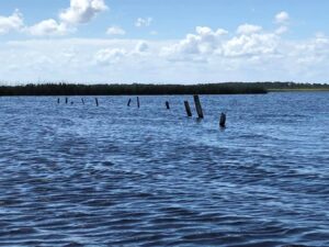
Mizell’s Ford 8-8-2020 Hike at Bull Creek. My passion for the history and exploration of the St. John’s River, its surrounding areas, people and places are a reward in and of itself. Reading, studying maps, talking to the old timers and others regarding this colorful history is noteworthy. Locating and finding Mizell’s Ford has been on my list of important places to find for a while. This is the very spot where the Barber Mizell Feud had its start. Today after talking with Billy Kempfer whose family history is also intricately entwined in the early history of this area, I’m finally standing on sacred ground. The Barber-Mizell feud in Brevard and Orange counties in 1870 resulted when Cattle Barron Moses Barber disputed the jurisdiction of Orange County Sheriff and tax collector David Mizell over land taxes, cattle and land boundaries. His brother John was the judge and had ordered his arrest. Both families came to Florida just before the 2ed Seminole War in the early 1830’s and both families lost sons in the Civil War 1860-1865. The Mizell’s lost two sons Thomas and Joshua and Mose Barbers lost his son Isaac. John Mizell was a Captain in the Confederacy and David Mizell a soldier. The Barbers supplied cattle to the Rebel forces thru out the war. The Mizell’s were part of the reconstruction and the Barbers sympathies still lay with the South. It was only a matter of time before these two powerful families and their allies would meet in conflict. Mose Senior had warned sheriff Mizell that he would be killed if he came onto his properties. As he crossed Bull Creek looking to find and arrest Mose Sr. David Mizell was ambushed and shot by Mose Junior and Needham Yates. His brother Morgan Mizell went for help while David’s son Will stayed behind with his father. As he lay dying David Mizell asked that his death not be avenged. That he was the first casualty he wouldn’t be the last. Before it was over 41 deaths would be recorded in the melee that followed with no criminal convictions. Standing here today at Mizell Ford in Bull creek, not far from where it joins Crabgrass creek then merges with Jane Green creek and into the amazing Jane Green swamp is humbling. Jane Green thru puzzle lake finally empties into the St John’s River between Lake Hell in Blazes and Little Saw Grass Lake. Named for a lady of pleasure who followed the lumbermen and cowboys around she was said to be smitten over Mose Jr. To be standing in such a secluded place in history on such hallowed ground gives me pause. I Appendage:October 2020After talking with Billy Kempfer we determined I was not at Mizell ford. The search continues..Mark Nathan
Listen >

St. Johns River Kayak Trip 6-13-2020

St. Johns River Kayak Trip 6-13-2020 Temperature: 72-82 Weather: Mostly Sunny Wind: Slight EastWater Surface: Flat to 12” Finally, after exploring these remote waters for the past year and a half today with good (high) water we were able to transit this entire isolated section of the St. Johns River. We put in at the hatbill sand ramp. Paddled through Lake Ruth, Clark, Loughman and finally into Salt Lake. Between the lakes like a spider’s web are miles of twisting, turning, tributaries. A confusing maze of dead ends, sandbars and due to rainfall or lack of low to no water. With these conditions it is no wonder this area like most of the 110 miles of the upper St. Johns can be so totally isolated. From SR 520 to SR 46 these 35 miles with its 5-mile-wide flood plain, including the area we paddled today, is surrounded by over 85,000 acres of pristine wilderness including: (East Side) Tosohatchee Wildlife Management Area, Bronson State Forest, Little Big Econ State Forest, Lake Jesup Conservation Area. (West Side) St. Johns National Wildlife Refuge, Salt Lake Wildlife Management Area, and Buck Lake Conservation Area. Although just to be here on the St. James is reward enough all of my trips involve information gathering: reading, talking with the old Crackers, Historical Societies, old County Maps and Records, before going out and trying to locate these landmarks from the past. Seminole war forts, trading posts, old military roads, river crossings, the indigenous Indian middens and villages, old homesteads and towns, historical battles and finally today after a few attempts what may very well be the remains of the loading dock on Salt Lake. It is important to understand the character of the river. From the mouth at Jacksonville the lower and middle section of the St. Johns River (200 miles) the water depth averages 11 ft. The upper St. Johns South, from Lake Harney to the headwaters at Fort Drum (110 miles) averages from 4 to 6 feet in depth with numerous sandbars and low water. Aside from the connective lakes the river sections here average from just getting your kayak thru to 40’. From Jacksonville to Enterprise on lake Monroe the large steamboats would have to unload their cargo onto smaller paddleboats for the journey south. From there they would get as far south and east to an area known as the Hatbill. Unless the water level was especially high they would have to unload yet again onto rafts which would then be poled east 5 miles to Salt Lake. There a 7-mile tram was constructed to Sandpoint in Titusville. The importance of the St. Johns cannot be understated. From the late 1820’s Until Henry Flagler brough his railroad through Central Florida in 1894 this was the sole means of moving people and product back and forth in Florida. These few docks sites at Salt Lake and at Rockledge creek off Lake Florence were crucial to the survival of these early settlers.To ply these same waters as the hearty pioneers long before, our journey today, those to come.With my good friend Jim Durocher.Mark Nathan

Listen >

St John’s kayaking May 1st 2020

St John’s kayaking May 1st 2020 Weather: Clear calm sunny; slight north east wind; 69-80 degrees. Time 10:05-2:50; Distance 10 miles Today’s paddle: From 192 north on river (2miles) into lake Washington. Skirt far west shore thru sand flats, islands of bull rush, coastal plain willow, and giant cane to a remote, ancient stand alone cypress (3miles) Counts: Gators nothing over 10’ Bald Eagle(1) Snail Kite(1) Purple Gullanule(3) Least Bittern(1) Great Egret(3) White Ibis(few) Limpkin(8-10) Boat tailed grackle, Spoonbill(1) Turkey and Black buzzards, Snowy Egret(1) Black Swifts (dozens)Solo.

Listen >

St Johns River Kayak Trip 4-7-2020

St Johns River Kayak Trip 4-7-2020 Weather: Mostly sunnyTemp: 75-84Wind: Slight eastWater conditions: Flat On this St Johns paddle trip, I was hoping to traverse into Salt Lake to try and locate the loading docks where the small paddle boats would tie up and unload their cargo of people and cargo from about 1850 to 1892. From there a 7-mile tram road ran to Sand Point in Titusville. Before Flagler’s Railroad came thru, Salt Lake and Rockledge landing off Lake Florence were Brevard county’s only life lines. Although Colonel Titus had built an almost impassable wagon road to the west side of Lake Harney called Tuskawilla landing, it was used only when the water level was to low to go any further South.We made it thru Ruth Lake into Clark Lake but the river channel into Loughman Lake and then to Salt Lake was impassable due to low water. Although our plan was negated, we headed to the north east side of Clark Lake to find the channel into Silver Lake. Of the five lakes in this furthest eastern quadrant of the St John’s it’s the only lake that’s secluded. Although the channel to Silver was also impassable, I knew we could hike the mile or so to the lake. This entire area of five lakes has a salinity about 1/3 of the ocean some 15 miles away. Here pockets of prehistoric salt water lie deep beneath the marshes of the St John’s bubbling up as salt springs.Although we didn’t make it to Salt Lake it was another incredible day on the St John’s. With my good friend Jim Durocher.

Listen >

St John’s River Paddle (Solo) 3-26-2020

St John’s River Paddle (Solo) 3-26-2020 Time: 11:07-3-18Total Distance: 8 Miles +Weather: Scattered Clouds– 74-80 degreesWind: Slight NortheastWater Conditions: Flat to Glassy From River at 192 to Lake Washington. On this 2.2-mile section I saw a dozen or more elusive green herons and as many limpkins, along with a few great herons, ospreys, turkey and black vultures, anhinga’s, as well as a curious juvenile little blue heron and a few adults. Only a few 7-8 foot gators. Once into Washington I skirted the west bank about 2 miles. The mud and sand flats were full of greater yellowlegs some moorhens and boat tailed grackles. There are no good places on shore to get out, but found an unoccupied gator crawl for a break before heading back. The solitude as always refreshing.

Listen >

St. John’s River Paddle Friday 2-28-2020

St. John’s River Paddle Friday 2-28-2020 Temperature 41-61 DegreesWind 7-12 mphWeather-Full SunWater Conditions-Choppy to Semi Flat(Medium to low Water)Time-10:20-5:55Mission-Locate the old Shriver House and any Remains.Mission-To Find The Confluence Where Cox Creek Runs Into Lake Winder. We snake around and thru the southern tip of lake Winder’s maze of islands of Maiden Cane,Bullrush, Switch Grass and floating Spatter-dock. There we see flocks of Greater Yellow Legs, along with the usual.. Great Egrets, Little Blues and Tri- Colored Herons, Snowy and Cattle Egrets, and our first Snail Kite. From there we paddle to the southern tip of Winder where it takes in the river and within a few hundred feet run into our first congregation of gators. They are all up in their crawls sunning themselves. There’s a dozen or so in this first group, from 7′ to 10′. We steady our kayaks as we ready for the bow wave as they all scramble and crash into the river for safety, one clipping the bottom of my boat in the melee. In the next few minutes there are fivemore groups from a few individuals to 10 or more. There are a couple of specimen bulls maybe 12 feet. The adrenaline rush in our kayaks at water level is riveting. The mouth of a river is where you can always be assured to find a congregation of gators. Soon we turn into a smaller tributary and look back to see about 60 sets of eyes and noses watching.It is good seeing this many large gators for I have noticed a sharp decline in the bigger specimen due to the needless annual gator “trophy” hunt. I have long proposed a slot limit of 4 to 9 feet to protect and insure we don’t deplete these quintessential iconic beasts. Killing only the biggest adults is not sustainable as the average size of the hunt is smaller every year. Sadly these breathtaking specimens are not as common.Once in the tributary we see dozens of Turkey and Black Vultures roosting in the Cypress trees. There are Killdear and Limpkins foraging on the sand bars. We startle two Black-Crowned Night-Herons as they hurriedly fly by, flocks of White and Glossy Ibis, Great and Common Egrets, Great Herons and Little Blue Herons, Even an elusive Green Heron puts on a show. We are now heading back North into Lake Winder, this time on the West side as we chase a flock of Curlew’s out ahead. In a few miles I’m standing in the trickle of what’s left of Cox Creek. As I thought, after almost a hundred years there are no remains left of the old wooden structure of the Shriver House. Even where it once stood is not certain. Although with all my research I know I’m close and can feel the breath from a long distant past on the wind. We head back across Lake Winder as the shadows grow long, even the lake is calmer now. There are two adult Bald Eagles and two Snail Kites soaring overhead leading the way… Remarkable… With Ernie Green.

Listen >

Bike and hike St. John’s River Thursday 2-13-20

Bike and hike St. John’s River Thursday 2-13-20 Thursday 2-13-20Bike and hike St. John’s River As always the isolation, solitude, beauty and seclusion, uncommon.I’m a good 45 minutes out, on my way back from an old shelter overlooking Lake Winder about a quarter mile away. The sage grass is a dazzling gold in the sun. I’ve already encountered a Red Tail an American Kestrel a pair of Red Shoulder Hawks a few Western Meadowlarks and even a Jake Turkey along the way. The shadows are long now and I’m riding a low trail below the only ridge in the area when I spook a sounder of wild hogs. They’re not sure where to go or what to do as 4 or 5 run single file parallel to me along the ridge about 25 feet away. There are some scrub oaks, palms, saw palmettos and switch grass between us which is somewhat comforting. They’re trying to get ahead of me, so the faster I go their going right along just above me. They’re all black silhouettes as they race along with me; the first two are both boars by their size. After a while they figure it out and I lose them behind me. Although the whole romp seemed like forever it was probably no more than 30 seconds.It could not have been a minute later as I turned a blind corner, and there 40 feet in front of me on a knoll was as big and as magnificent a bull as I’ve ever seen. He was solid black with his back to me as he was chomping some sage grass. I stopped and he turns towards me and stares. I know the most dangerous thing out here in this remote wilderness is not the gators, hogs, snakes or even the elusive swamp ape; it’s a rogue range bull. If he charges he’s only seconds away and the trail I’m on, alone, is low and wet. I didn’t want to give him any time to think so without making eye contact I walk my bike by him. The St. John’s as always a delightful uncertainty.

Listen >

St. John’s River Paddle. 1-28-2020

St. John’s River Paddle. 1-28-2020 From: Hatbill Sand Ramp, Thru Ruth Lake, Clark Lake, SJR into Loughman Lake.Objective: To locate “Indian Fields Mound Midden on Ruth Lake from the indigenous Timacun Indians dating back over 6000 years.Objective: To explore the remote river section between Clark and Loughman Lake. The St. John’s River between 50 and 46 is a 7 mile wide flood plain with more confusing twists and turns, connective lakes, sloughs, sandbars, waters to shallow to paddle, dead end backwaters and perplexing river channels. It is imperative to be able to read and know this river for GPS is not always guaranteed here.The river’s edge is not defined as such but continues on in ankle to knee deep water thru an impenetrable maze of amazing flora of every description. It is always a challenge to find your way thru this confusing labyrinth of puzzle and beauty for there is no one here but you. The surrounding area is over 90 thousand acres of forest, cypress swamp, savanna and marsh including Tosohatchee WMA, Bronson State Forest, Little Big Econ WMA, Buck Lake Conservation Area, and Seminole Ranch WMA. Here as in most of the Upper St. John’s the desolation and solitude of this wilderness is uncommon, worth the effort, the challenge the risk.With Dan Bryant.

Listen >

St. Johns River Friday January 17th 2020

St. Johns River Friday January 17th 2020 A few pictures of my ride and hike on the St. Johns River Friday January 17th 2020. While talking to my friends at the brevard historical society – Bob an archiecolgist told me he had left his favorite probe on one of the Indian Middens a couple of years back. Since this is such a remote area chances were good it was still there. I had paddled Ruth Lake last year into Lake Clark to see the white pelicans. But time didn’t allow me to stop and check out Indian fields mound and that is was across to the other side. So Friday I decided to bike and hike between Loughmanand Lake Clark then hike my way around the backside of Ruth Lake through piney flat woods and oak hammock. An old delapated observation tower built years ago sits just east of Loughman on the river. There was no way to ford the river here.It was sixty feet across, too deep and moving at a pretty good clip. So I climbed up the towers two flights of steps with my bike, across the gang plank, over the river and down the other side. I biked another clip or two to another riverChannel. There was a 10 foot gator laying at the mouth. I really wasn’t too worried as I started to cross but in just 10 feet, I was already up to my knees and my front tire had disappeared. The bottom was rocky and sandy which was goodbut my real concern was my iphone without its waterproof case and my wife Kathy. I had already crushed one phone and drowned two more. No way could I afford a forth. So I headed back across the tower over the river and thru the woods back to my truck. I was probably less then twomiles to my destination. By now it was after 1 oclock. There was still some good daylight left so I drove over to Salt lake wildlife area to find my way around on the trails on this side to Ruth Lake and Indian Fields Mound. I guessed about 10 trail miles. Salt Lake is 8000 amazing acres of piney flatwoods with an impenetrable understory of saw palmetto, salt marsh, loblolly bays and some cypress stands. I went thru a heart of pine savanna with patches of sand live oaks, a perfect habitat for the Florida scrub-jay which I saw none. The trails were overall pretty good going thru a foot or more of water in some of the low lying areas. The trees are starting to steal the light as the sun is closing out the day. I’m still about that same two miles from Ruth, now from the other side… Another day. Saw no one all day. Just me.

Listen >

Bike Ride on the St John’s

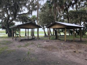
Bike Ride on the St John’s Great 3 hour bike ride on the St John’s. 10-18-2019. New shelters at the Oaks! As always the solitude and peace uncommon. With Rich Ataman.

Listen >