Search

Category: Adventures

St. Johns River Kayak Trip October 19th 2022

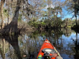
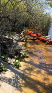
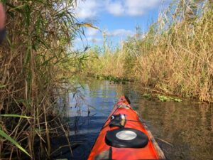
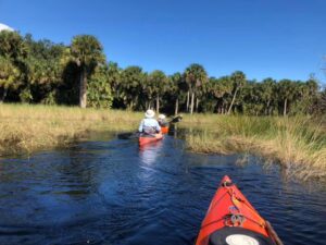
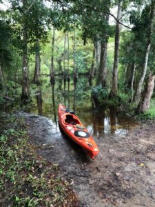
St. Johns River Kayak Trip October 19th 2022 9:30- 5:30 (8 hours)Weather:Temp 58-71Cloudy with SunWind to 15mph The first cold front this Fall came thru last night.We’re in the 50’s as we head out from lake Winderto Penny Wah Swamp a good 8 miles South.Hurricane Ian has left the St Johns in flood stage.There is literally nowhere to stop and get out.No inside sandbars and the nearest Indian Middenis back on the South West side of Winder. With high water Penny Wah is as spiritual as it is peaceful. In this quiet, which it always is you can imagine the Seminoles dipping their paddles from their canoes and before them the Ais and the Timucua and now us.Last year when I was here, I hiked thru where we paddled today. True the bigger Cypress are gone but still if there’s a greater presence than us, her spirit surely lives here. With my nephew Troy. “I strive to be one With all living thingsGreat and smallThat we come togetherAnd share this same worldIf only for a moment” Mark Nathan

Listen >

St. John’s River Trip July 13th 2022

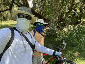
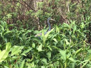
St. John’s River Trip July 13th 2022 4+ Hours / 9+ MilesBike and HikeSunny to Partly CloudyTemperature 92-94Heat Index 103-105 Our trip today on the St. John’s is to bike from Moccasin Track (South) on an old jeep corridor than off road to the St. John’s River Marsh, 3> miles.From here we’ll hike another hard 1> mile down a dry tributary to the river between Lake Washington and Lake Winder. With the Summer season and little rain, other than a couple of gator holes and a large shallow depression there is little to no water. Dry or wet this vast fresh water marsh still flourishes. The Crimson eyed Rose Mallow in vast fields sways to the whim of the wind. Resistant to almost all pests and disease the Rose Mallow thrives here.Other marsh plants include Bull Rush, Sand Cord Grass, Switch Grass, Giant Maiden Cane and Coastal Plain Willow along the river banks. In the middle of the day with 105 heat index wildlife is scarce. There’s a couple of tri-colored herons a green heron and two young moor hens at the first gator hole. Around the gator hole is wet and spongy as you have to watch where you put your weight. Suddenly I find myself crashing thru the dishonest crust as I’m almost up to my waist in the thick sucking peat. In such a maze of daunting beauty, that is the St. John’s Marsh, it’s not easy to follow the dry tributary that is covered over in this bountiful flora. As a guide you have to be able to read the land as well as the river. From the second gator hole the channel totally vanishes, awash in a sea of green.Looking out ahead toward the 12’ Giant Maiden Cane, which sporadically covers the marsh in thick impassable rowsI spot an obscure break in the cane and sure enough that’s the channel/animal trail.With an active trail for Hogs, Deer and other animals including Gators during the wet months the cane grass here can never take root, so the passage stays open.After a long hard hike thru this amazing fresh water marsh, we make it down to the river. With camp sites nearly nonexistent on the upper St. John’sthe purpose of this trip is to find an alternative kayak route off the river to an upland area. With good water this is a viable option for a camp site or for an emergency. With my good friend Ernie Green.Addendum:If a fire starts in a bone-dry marsh, which the marsh here was not, it’s easy to understand why so many deaths were recorded from the pioneering families who farmed, ranched, trapped and hunted this land. Unless you’re as fast as the wind it’s almost impossible to outrun a marsh fire. Trying to run any distance crashing thru hip deep dry litter is nearly impossible. Mark Nathan321-543-0373

Listen >

St John’s River Kayak Trip: May 10th 2022

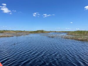
St John’s River Trip – February 20 2023 My journey today is another attempt to find “Indian Fields” Indian Midden. This time I have new coordinates courtesy of “Florida Trailblazer”. From Hat bill sand ramp taking the East fork on the St John’s River, about a mile. Then turn South and skirt Ruth Lake, into a 20+ mile per hour East wind. I’m taking the waves broadside and even though I’m tacking into the bigger sets, I’m still getting soaked. From Ruth I’m kayaking new waters and into a labyrinth of tributaries. I find the furthest tributary East up against Salt Lake WMA. 8000 acres of Piney Flatwoods, Hardwoods, Scrub and Freshwater Marshes and then head South. In an area where I seldom see big gators, I am happy to see a half dozen 10 and 12 feet. Paddling by and thru this Freshwater Marsh is extradentary. Hundreds of acres of golden Cord Grass, Bull Rush, Willows and some Cane Grass. Where the Cord Grass abuts the forest is where the St John’s River Basin ends and the upland forest begins. The St John’s flood plain here is almost 8 miles across. The forest is old growth Sabal Palm, Oak, Cedar, Bay and some giant Long Leaf Pine. I find a spot thru the Cord Grass on an animal trail (probably hog) where they all come down to drink. The Peat is 3 feet deep before I hit bottom with my hiking stick. The trail is only 2 feet wide but thankfully here, only about 40 feet to the forest edge. I get out of my kayak and stay to the edge, walking on the matted Cord Grass. I’m to the forest edge in a bright sun. Even though there’s not a lot of under story, it’s not easy to find a way in, thru all the fallen debris. I hack my way in, and from a bright sun I’m into literally a black forest. All the trees are massive and crowd into the canopy. There is no sunlight falling in here. Even the Sabal Palms are over 60 feet tall, just to keep up. I head toward my coordinates, but with fallen trees and debris it’s hard to keep a track. Luckily, I run into an animal trail, an even though it’s not a direct route I’m going in the general direction. Soon enough I run into an abandoned service road. Although totally over grown it’s passable. I believe I’m close now… And there it is. Indian Fields Midden. After a few years and attempts, I’m finally here. I find no shards of pottery laying on the surface and digging is not an option. The midden is about 10 feet tall and at least 100 ft across, with a giant 12 ft Oak at the top. Probably Ais Indians about 6000 years before. I stay for some time in awe and wonder, trying to connect with such a sacred place and the people who left it. I leave here and continue south thru more remote water. The water is plenty deep, for my kayak but I have to pull over the occasional sandbar. I turn West into another small tributary into one amazing slough after another. Most of the birds are feeding alone or in small flocks. I’m as far West now as the river goes and with a late afternoon sun I head back. Mark Nathan

Listen >

St John’s River Trips: March 10th 2022

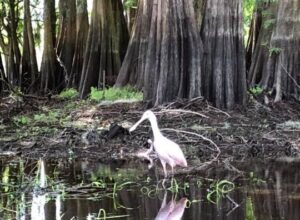
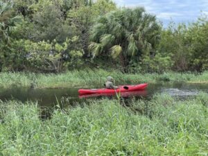
St John’s River Trip 2, 10, 26th and March-2-2022 I am posting a compilation of 4 trips together on the St Johns River. All of these exploratory trips are in the hard to access Taylor creek swamp flood plain. February 2-10&26 and 3-2-22. Three were kayaks and hikes and one was a bike/hike deep into her trackless tannic shallow waters (solo). Some of our earliest settlers homesteaded here. The Nettles, Coxes and Savage families settled here right after the Seminole War (1835-1842). The Taylor creek community was off the old military trail, parts of which are now Nova and Taylor roads. Ft. McNeil was built nearby in 1838. There were weddings, 4th of July celebrations, horse racing, even a school. During the 2ed Seminole War one of the biggest battles in this area was fought here to a draw. The soldiers were on the North side of the run and the Seminoles on the South. By morning the Seminoles had moved South, which necessitated the building of Fort Taylor about 6 miles South on Lake Winder. With all the miles and days I explored, paddled and hiked thru the Taylor Creek swamp flood plain, other than some old Cypress stumps and echoes in the wind, I found no trace of anyone ever being here.As you can see in the pictures this remote primordial swamp seems healthy. The Cypress trees here are between 200 to 400 years old. A few were over 12’ in circumference. One giant Cypress that was completely hollowed out could easily fit 6 men inside. I guessed its circumference, due to being covered in poison ivy at 20′, maybe 500 years old. Along with the cypress were old growth Sweetgum, Oaks and Sabal Palms. Unfortunately all the many swamps and tributaries, on the Upper St John’s, most of which I’ve been thru are severely diminished. Whether damned, diked, bermed or just starved of water they no longer flow as nature intended. And as we all know water is life.Surrounded by hundreds of thousands of acres of wilderness, the Upper St John’s (130 miles) from its headwaters at Fort Drum thru Lake Harney still holds the promise of her right to exist in perpetuity. Although compromised by man’s callous, self serving quests, she still thrives. Sadly because of unbridled growth and indifference, I just don’t know how much longer before man’s heavy hand takes yet another piece of Florida’s disappearing irreplaceable wilderness. With Ernie Green.Mark NathanAddendum:We made 4 different trips into Taylor. One from Nova road, West to East. From the St Johns River, South and West. From Lake Poinsett into a tributary, South and West and a solo 4 mile bike & hike South on Taylor creek loop and than 2 miles of bushwhacking into Taylor creek swamp. In conclusion, I believe before the power line berm was built, Taylor creek along with its vast sheet flow did connect with the tributary we paddled and into lake Poinsett. Mark Nathan

Listen >

St. Johns River Paddle Trip 4-26-2021

St. Johns River Paddle Trip 4-26-2021 Time: 9:23-5:28Distance: 16.4 milesTemp: 69-79Weather: Mostly sunny with cloudsWind: SlightWater: Low Because of the distance, I knew our journey today to Penny Wah Swamp, up and back would be a challenge. We paddled through the south end of Lake Winder into the south river channel, where as usual no less than fifty gators of all sizes greet us. From here it’s another 3 miles to an unremarkable slough, with two obscure tributaries far to the west into Penny Wah. With lower water levels then expected one of the tributaries is unpassable. The other one gets us into the furthest eastern section of this primordial, haunting swamp. Paddling through these silent waters I feel like I’m back in time with the Ais Indians, bows drawn as we invade their precious haunts. Two red-tail hawks scream their displeasure as we near their nest high into the canopy. A piliated woodpecker drumming far in the distance. We paddle back as far as we can before our kayaks become grounded. From here we hike the ancient riverbed of Penny Wah Creek. The cypress standing straight and tall like sentries, unsure as they should be, of our intent. Gone are the three-thousand-year-old virgin stands of cypress that stood against the world for millennia, but couldn’t stand against man and steel, our audacity and recklessness. Curious that George Hobkins and his lumber crews, a hundred years ago didn’t seem to log here, in that there are no stumps to be found. Hobkin’s railroad, “The Union Cypress Railroad” that took the trees to his sawmill in South Melbourne was far to the west of our location. The trees here in Penny Wah and Wolf Creek, three miles further north may have been to far east and too small to bother. Many of the cypress here are 3-5 feet in diameter. It typically takes 350-400 years to reach a diameter of 3 feet and perhaps 800-1000 years to reach 6-7 feet. Although we didn’t make it into the heart of Penny Wah and I am not a religious man but if there is a God, she lives here. With Ernie Green.

Listen >

St. John’s River Paddle Trip (Solo) April 14th 2021

St. John’s River Paddle Trip (Solo) April 14th 2021 Weather: Sunny 66-82Wind: Slight South EastWater: High My trip on the St John’s today was to physically find Hobkins canal. An ill attempt to connect the St. Johns to the Indian River. George Washington Hobkins was an experienced lumberman, surveyor, and railroad builder from Michigan. From 1902-1907 he purchased 104,000 acres of choice country for $1.04 an acre around a small ranching community called crabgrass. This land lay west of Eau Gallie and Melbourne stretching for miles along the St. John’s with 58,000 acres of virgin forest. This included 240 million board feet of Longleaf and Slash Pine, on the uplands and 225 million board feet of Bald Cypress in the magnificent Jane Green, Penny Wah and Wolf Creek swamps. In 1911 Hopkins constructed his saw mill in south Melbourne, which was called Hobkins. The mill was located just South of Crane Creek on the Florida East Coast Railroad Line. By 1912 Hobkin’s rail line (Union Cypress Railroad) from Crabgrass (Deer Park) to the mill was complete with a spur line into the Jane Green Swamp, and 300 men on payroll. By March 1914 there would be 600. With Penny Wah and Wolf Creek swamps miles to the South of Hobkin’s rail line a canal from lake Washington to Crane Creek and the mill would have saved time and money. Although Hobkin’s Canal was never completed, from 1912-1932 all the virgin pine and cypress that literally took centuries to create was totally gone in just 20 years, and will never be again. I have paddled and hiked thru, all the majesty and awe of these amazing swamps and they are breathtaking even today. I can’t imagine what they were then. Mark NathanSt. John’s River Guide Historian

Listen >

St Johns River Kayak Trip: Jan 7th 2021

St Johns River Kayak Trip: Jan 7th 2021 Weather: cloudy Temp: 60-67Time: 11:40-4:05Wind: 5-15mphWater: smooth to choppyFrom: Jolly Gator-river channel intoLake Washington thru Bullrush Islands. A nine mile round trip which I saw 3 gators 8’ 10’ and one 12!All birds were 1-2 and 3’s to handfuls Including: Great Heron’s, Little Blue’s, (many juvenile)Tri-colored, Snowy Egret’s, White Ibis, Ospreys, King Fisher, Anhingas and Cormorants, Black and Turkey Buzzards, Limpkin, I was lucky and saw two Purple Gallinule’s, but unfortunately no pics of these elusive birds. Where the river goes into Washington I was fortunate in finding hundreds of Least Terns in a feeding frenzy. And oh yea a 16” Spotted Gar that jumped into my boat between my back and seat. I had to paddle 20 minutes before I found a Gator crawl to stop and release my captive. With those teeth I was hoping he wouldn’t bite my ass. Great day.

Listen >

St. John’s River trip Dec 14-15, 2020

St. John’s River trip Dec 14-15, 2020 Where: Salt Lake areaWhen: December 14th and 15thWeather: Monday -mostly cloudy misty rainWeather: Tuesday – mostly sunnyWind: Slight WestTemp: 56 -72 degrees The latest trip on the St. John’s from the Hatbill takes us thru Ruth Lake into Clark Lake. From there we take a side trip to paddle a channel into remote Silver Lake. Then back out, into Clark and thru a winding narrow mile long passage into Loughman Lake. There islands of bullrush and maiden cane sing in the wind as we paddle thru the heart. The dense Cord grass along the shoreline turns from a dark green to a wheat hue under the late Autumn sun. Finally, after 2 miles we find the elusive river channel, with its many confusing tributaries that will lead us into Salt Lake. The purpose of the journey, other than the beauty of it all, is to locate Shad creek and map out the many confusing and hidden passages that is Salt Lake. Lying deep beneath these marshes, pockets of prehistoric salt water bubble up as salt springs. As a result, the salinity of South Lake, Loughman and Salt Lake has a salinity of nearly one third that of the Ocean. This enables salt loving plants, marine crustaceans and salt loving fish to live in what is a fresh water river. Every year beginning in mid-December till early March the St. John’s comes alive with Shad as they migrate on their long journey from the Ocean to spawn in these waters, much the same as Salmon.After an amazing day exploring, the shadows are casting long, the sun low, as we finally find a small palm hammock on the South end of Salt Lake that is dry enough to camp. We pull our kayaks some 30 feet thru the thick cord grass in ankle deep water. The next day we wake to a clear sky after a windy cold night. The morning fire always a comfort. We spend the next morning and afternoon exploring some of the channels, sloughs and unnamed hidden lakes, on the North side. As always uniquely secluded.Footnote: The White pelicans arrive on the St john’s in late Fall, from the Central Plains and Canada. The area from Lake Harney, North, to Fort Christmas, South support some 500 to 600 hundred of these huge birds. Whether we just didn’t see them or it’s just too early, we saw none.With my friend Ernie Green.

Listen >

St John’s River paddle trip Monday 11-23-2020

St John’s River paddle trip Monday 11-23-2020 Journey: 15.5 miles Time: 8:45-6:10Temp: 66-75Weather: morning mostly cloudy – afternoon mostly sunnyWind: strong north to 20Water: 2 foot plus in sets Trip: Exploratory into lake Winder by way of Moccasin Track. North on Winder, into a north wind, to 20 mph, swells to 3 feet. Were able to avoid some of the waves by paddling east side of lake past Moccasin Island into a labyrinth of hidden passages and quite waters. Once thru Winder, we traveled the river north two miles to the second slough on the west side, then to the far southwest corner, where a small obscure opening takes you into an amazing fresh water marsh ending at the shore of a hydric forest. Because of high water this isolated marsh seemed endless. The beauty forsaken. The cord sawgrass in all their glory, as the sun drenched their golden blades and the wind swayed the grass, as if they were alive. After a break at the forest edge we made our way back to the river and another 1 1/2 miles into another tributary that would eventually lead to Lake Florence and into Rockledge creek, where once stood the Rockledge paddleboat docks. I-95 sits there now. Before the railroad that came thru in January of 1893, Rockledge Landing and the boat docks at Salt Lake, near Titusville were the only means of transportation for people and product for Brevard County. With long shadows creeping in and a ways to go, we turn around and head back. From our put in, Lake Florence is not possible without an overnight, which was not planned. Back into Lake Winder with the sun going down, I won’t waste words in trying to describe the beauty of this magical remote place, like we’re the only ones in the world. Now heading South on Winder with a strong north wind, now on our backs, we are now dealing with an unpredictable following sea. One boat is flipped in the churning waves and we stop at Moccasin Island to build a fire to warm. With darkness falling the moon is bright enough to make the last mile home. Although I have head lamps in my boat, I don’t need them. By now the mosquitos are swarming. Another memorable adventure on the historic St. Johns. With my English Blokes Ernie Green and Jason Reed.Mark Nathan

Listen >

Bull Creek Kayak Paddle: 9-18-2020

Bull Creek Kayak Paddle: 9-18-2020 Where: Herky Huffman / Bull Creek WMAWhen: 9-18-2020Weather: Cloudy and RainTemp: 78-84 Wildlife: Very little. Small gators, including gator hatchlings. Heard Hawks and Woodpeckers including Piliated, Barred Owl. Oh yea! Lots of spiders, lots of big spiders.Bull Creek WMA is part of the St. John’s River basin it consists of 24 thousand acres of Open Pine Lands,Mesic Flatwoods, Hydril Hammock, and Flood Plain Swamps. Bull Creek merges with Crabgrass Creek and finally the Jane Green. Smaller tributaries Little Creek, Little North Prong, West Branch, Yoke Branchand others all contribute their share. Jane Green flows into the amazing Jane Green Swamp and finally into the St. John’s between Lake Hell and Blazes and Little Saw Grass.As an amateur Historian I’d been trying to locate Mizell Ford, where in 1870 Mose Barber Jr. shot and killed Sheriff David Mizell as he was crossing Bull Creek. This one act started the biggest feud in Florida history. Although the feud between the Mizell’s and Barber’s was short lived at the end 41 cowboys had been killed. I’d originally thought I’d found the crossing while thru hiking but wasn’t sure. So, I contacted Billy Kempher the great great grandson of William Hopkins who came to Florida in 1888 and purchased his first tract of land. in 1902 he purchased another 96 thousand acres for a dollar an acre, including the Bull Creek WMA. The Kempher Cattle Company still own and operate 25 thousand acres of these same lands.Billy thought I was probably at Yoke Branch and gave me direction where Mizell Ford was located. Looking at maps I thought if I put in at Billy Lake I could paddle thru this small lake, which is part of Bull Creek and thru its massive flood plain to Mizell Ford. I’d been told by an avid hunter, familiar with the area that as far as he knew no one had ever made this journey, but because of all the rains it might be passable.We put in at Billy Lake late-morning in a slight drizzle, 25 minutes later we were in the first of two hard rains. The next 2.5 hours was one of the most challenging paddles, I’ve had the pleasure. As beautiful as this Black Water Swamp is you need be vigilant. With the Bull Creek flood plain as far as the eye can see and only intermittent GPS coverage, reading the water was imperative. Fortunately, the hard rains had created bubbles which made it easier to follow the so-called channel. Because of refuge, fallen trees, countless Cypress trees and knees we would constantly have to skirt around, yet no portages. Surprisingly Bull Creek is deep water, deeper than my paddle could touch. The water levels were only about a foot lower than the high-water marks on the trees. With my GPS off line we had to back paddle to Mizell Ford. We stayed for a half hour to soak in this iconic time forgotten place. The serenity and quite that a gun shot once broke. With thunder heads to our South we headed back. The rains had stopped, the tracking bubbles gone, I smiled and said “Hope we make it back by dark”.With my good friend Ernie Green.Mark Nathan

Listen >